If you’re heading to southern Spain, a tourist map of the province of Malaga will quickly become your best friend. This corner of Andalucía is famous for its coast, but that’s only half the story. The map is packed with whitewashed mountain villages, Moorish castles, Roman ruins, national parks, and a coastline stretching from Nerja to Manilva. With so much to see, a little orientation makes all the difference.
Where is the Province of Malaga?
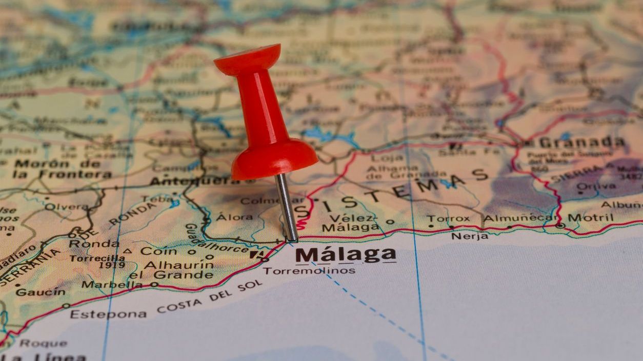
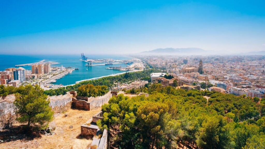
Pull out a map of Malaga province and you’ll find it in the heart of Andalucía, bordered by Granada to the east, Cádiz to the west, Córdoba and Seville to the north, and the Mediterranean to the south. Its capital, Malaga city, sits roughly in the centre of the coast, making it a useful base.
The tourist map of Malaga province shows two very different landscapes: the lively Costa del Sol on the shoreline, and the rugged interior filled with sierras, olive groves, and historic towns. The contrast is what makes the region so appealing. You can swim in the sea in the morning and be hiking in the mountains by the afternoon.
Key regions and towns to explore
Looking at a map of the province of Malaga, several areas stand out for visitors:
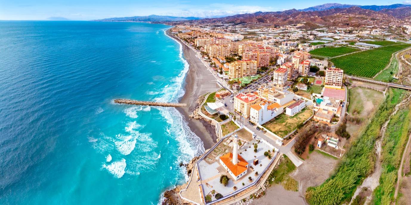
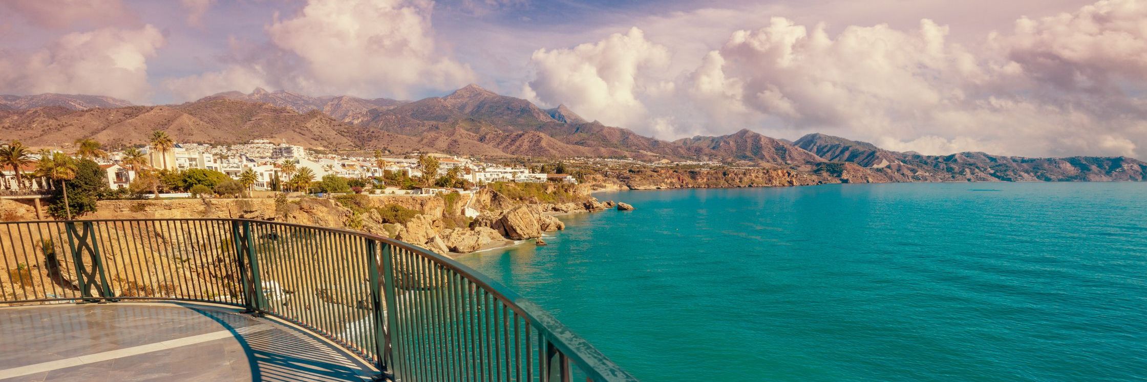
- Costa del Sol: Stretching along the Mediterranean, this is where you’ll find Marbella, Torremolinos, Nerja, and Estepona. Each town has its own character, from Nerja’s caves to Marbella’s marina.
- Axarquía: East of Malaga city, this hilly region is dotted with vineyards and pretty villages like Frigiliana and Cómpeta.
- Antequera: Known as the crossroads of Andalucía, this inland town is full of historic churches and close to the striking rock formation of El Torcal.
- Ronda: Perched above a gorge, it’s one of Spain’s most dramatic towns, with Roman, Moorish, and Renaissance influences.
- Inland villages: From Mijas Pueblo to Gaucín, these white towns offer quieter stays with unbeatable views.
Each of these areas has its own draw, so spreading out your time across the tourist map of Malaga province is the best way to see it all.
Must-see attractions
Everyone has heard of the Picasso Museum in Malaga and the Alhambra in nearby Granada, but the province has plenty of highlights of its own.
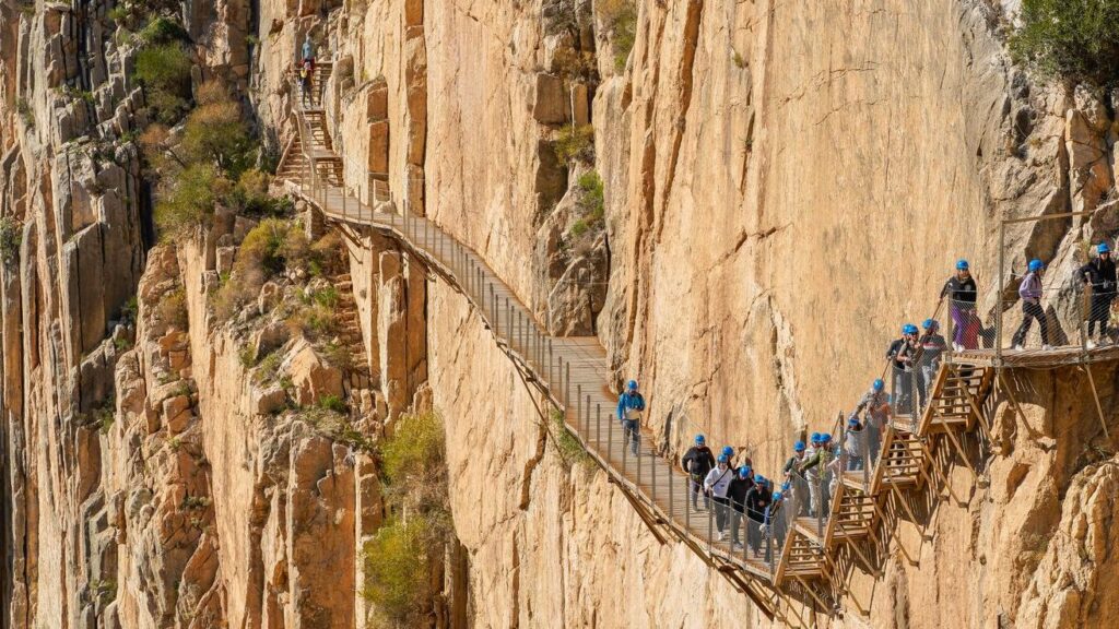
Start with the Caminito del Rey, once one of the most dangerous walkways in the world, now a safe and spectacular hiking trail through the Gaitanes Gorge. Then there’s the Nerja Caves, a vast underground network with prehistoric paintings.
Ronda’s Puente Nuevo bridge is a showstopper, but don’t miss the Arab Baths or the Mondragón Palace while you’re there. Antequera is home to the Dolmens, megalithic tombs that are UNESCO-listed. For something less obvious, head to Archidona with its octagonal plaza, or Villanueva de la Concepción, the gateway to El Torcal.
The map of Malaga province isn’t just about headline sights. It’s about those hidden finds that make you feel like you’ve stepped off the beaten track.
Best beaches and nature spots
The Costa del Sol is well known for its stretches of sand, but there’s plenty of variety if you know where to look. Nerja’s Burriana Beach is family-friendly with all the facilities you’d expect, while Maro Beach, just along the coast, is quieter and great for snorkelling.
For wide, sandy expanses, try Playa de la Malagueta in Malaga city or Playa de la Rada in Estepona. Those after something wilder should head west to Playa de Artola-Cabopino, backed by sand dunes.
Nature lovers shouldn’t stop at the coast. The Montes de Malaga Natural Park is right on the doorstep of the city, while Sierra de las Nieves, now a national park, offers serious hiking terrain. The flamingos at Fuente de Piedra Lagoon are another surprise for those willing to go inland.
A tourist map of Malaga province helps balance beach days with mountain escapes, so you don’t end up missing half of what’s on offer.
Tips for planning your route
A province this varied deserves a bit of forward planning. Here are some practical pointers:
- Transport: The coastal train links Malaga city with towns like Torremolinos and Fuengirola, but inland villages are best reached by car. If you want to see beyond the resorts, hiring a car is the easiest option.
- Timing: Summer is hot and busy, especially on the coast. Spring and autumn are better for hiking and sightseeing, while winter can still be sunny enough for a coffee on the beach.
- Pace: Don’t try to cover everything in a week. Pick a base, whether that’s a beach town or a village inland, and explore nearby areas. The tourist map of Malaga province is dense with options, but less is often more.
- Local style: Build in time for tapas stops, market visits, and slow afternoons in plazas. These unscheduled moments often turn out to be the most memorable.
Malaga Province is worth discovering
The tourist map of the province of Malaga is more than just a diagram of roads and towns. It’s a reminder of how much variety can be found in one corner of Spain. From the coast to the sierras, from lively resorts to sleepy villages, the province offers something for every traveller.
If you’re planning a visit, make it easy on yourself by staying somewhere comfortable and well-located. At Home offers everything from stylish apartments by the sea to larger villas inland, so you can explore at your own pace and return to a place that feels like yours.
Check out what’s available and start planning your route around the province today.